Residents urged to remain vigilant as September 19–25 identified as a critical period for potential flooding.
ABUJA, Nigeria — Nigeria’s flood preparedness efforts have received renewed attention following a high-risk riverine flooding alert issued by the Nigeria Hydrological Services Agency (NIHSA), covering September 19 to 25, 2026.
The warning affects 15 states across different regions of the country, raising concerns about possible flooding in communities located near rivers, waterways and other vulnerable areas.
The affected states are Imo, Cross River, Ebonyi, Benue, Anambra, Akwa Ibom, Lagos, Rivers, Edo, Kogi, Taraba, Delta, Bayelsa, Enugu and Abia.
Although the alert identifies areas at heightened risk, it does not mean that every community in these states will experience flooding. The actual impact will depend on rainfall, river levels, drainage conditions and local geography.
NINE RIVER STATIONS UNDER CLOSE WATCH
As part of its monitoring efforts, NIHSA has identified nine river stations for close observation during the alert period.
These monitoring points are important because rising river levels can provide early indications of potential flooding, particularly in communities located along riverbanks and low-lying areas.
However, riverine flooding can develop rapidly when heavy rainfall coincides with already elevated water levels. Residents in vulnerable communities are therefore encouraged to pay attention to official updates and warnings from relevant authorities.
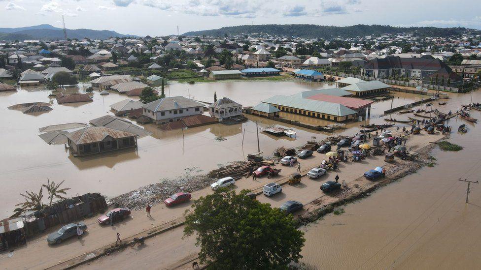
WHY THE WARNING MATTERS
Flooding remains a recurring environmental challenge in Nigeria, with the potential to disrupt transportation, damage homes and businesses, affect agricultural activities and threaten lives.
For communities in states such as Benue, Kogi, Anambra, Rivers, Bayelsa and Delta, where rivers and waterways play significant roles in local livelihoods and transportation, heightened river levels could create additional risks.
In urban areas, including parts of Lagos and other affected states, heavy rainfall may also expose weaknesses in drainage systems, although the current alert specifically concerns riverine flooding.
⚠️ WHAT RESIDENTS SHOULD DO
People living near rivers, streams and flood-prone areas are advised to take the warning seriously and prepare for possible changes in weather and water levels.
Authorities and residents can help reduce the risk by:
- Monitoring official flood alerts and weather updates.
- Avoiding unnecessary travel through flooded roads and waterways.
- Moving valuables and important documents to safer, elevated locations.
- Keeping drainage channels free of refuse and obstructions.
- Preparing evacuation plans, particularly for households in low-lying communities.
- Reporting dangerous water levels or flooding incidents to emergency agencies.
Residents should also avoid attempting to cross fast-moving floodwaters, whether on foot or in vehicles.
AUTHORITIES URGED TO MAINTAIN VIGILANCE
The identification of nine river stations for close monitoring underscores the importance of continuous observation during the alert period.
Effective flood management requires timely communication between hydrological authorities, state governments, emergency agencies and local communities.
For residents in the 15 affected states, the message is clear: the alert is a warning to prepare, not a reason to panic.
As September 19–25 unfolds, continued monitoring of river levels, rainfall and local conditions will be essential in determining how the situation develops.
Residents are encouraged to rely on official updates from NIHSA and relevant emergency management authorities for location-specific information.